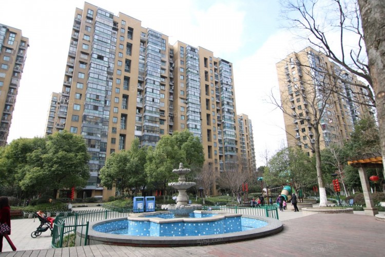
Neighborhood Information
Jianqiao Street currently has 9 communities (including Fanjia, Nongkou, Huayuan, Caozhuang, Baishi, Jianqiao, Agricultural Academy, Gouju Niang, and Airport), 7 administrative villages (including Jianqiao, Yuzhang, Liming, Tongxin, Huangjia, Banghe, and Hengtang), and 1 economic organization (Zhalongkou Economic Cooperative). The former Dongjia Village, Sanliting Community, and Zhalongkou Community are now part of Zhalongkou Street. The total area is approximately 18.2 square kilometers. It is adjacent to Jiupu Street in the east, borders Pengbu Street and Kailun Street in the south, meets Zhalongkou Street in the west, and relies on Dinglan Street in the north. The total number of households in the town is about 8,282, with a population of over 38,000 permanent residents and approximately 82,000 non-permanent residents, totaling 120,000 people. The town is home to units such as the Nanjing Military Region Airborne Jianqiao Street currently has 9 communities (including Fanjia, Nongkou, Huayuan, Caozhuang, Baishi, Jianqiao, Agricultural Academy, Guju Nong, and Airport), 7 administrative villages (including Jianqiao, Yuzhang, Li Ming, Tongxin, Huangjia, Banghe, and Hengtang), and 1 economic organization (Zhalongkou Economic Cooperative). The original Dongjia Village, Sanliting Community, and Zhalongkou Community are now part of Zhalongkou Street. The total area is approximately 18.2 square kilometers. It is adjacent to Jiupu Street to the east, connected to Péngbù Street and Kailun Street to the south, borders Zhalongkou Street to the west, and depends on Dinglan Street to the north. The total number of households in the town is about 8,282, with a permanent population of over 38,000 and a non-local population of approximately 82,000, making the total population reach 120,000. The town is home to units such as the NanjingJianqiao Street has a total of nine communities, including Fanjia, Nongkou, Huayuan, Caozhuang, Baishi, Jianqiao, Nongkeyuan, Gujienong, and Airport. There are seven administrative villages, including Jianqiao, Yuzhang, Liming, Tongxin, Huangjia, Banghe, and Hengtang. There is one economic organization, Zhalongkou Economic Cooperative. The original Dongjia Village, Sanliting Community, and Zhalongkou Community are now under Zhalongkou Street. The total area is approximately 18.2 square kilometers, adjacent to Jiupu Street to the east, connecting with Pengbu Street and Kailun Street to the south, bordering Zhalongkou Street to the west, and neighboring Dinglan Street to the north.
The town has a total of about 8,282 households, with a permanent population of over 38,000 and a floating population of about 82,000, bringing the total population to around 120,000. Units stationed in the town include the Nanjing Military Region Air Force 28th Division and the Provincial Academy of Agricultural Sciences. The town's Party Committee has 30 directly affiliated party branches (including 24 in enterprises), 9 party general branches (including 1 in an enterprise), and 7 party committees (including 3 in enterprises), with a total of approximately 2,500 party members. There are 1,634 enterprises in the town, including three at the national level and eight at the provincial level.
Nearby Metro Stations
| Station |
Line |
Distance |
Walk Time |
Coordinates |
| Gubeili Nora Metro Station Exit C |
Line 6 |
352 m |
≈ 4min |
120.206550, 30.300581
|
| Guangzhou Academy of Fine Arts Metro Station Exit D |
Line 6 |
363 m |
≈ 4min |
120.206963, 30.301451
|
| Cizhong Nong Station |
Line 6 |
383 m |
≈ 4min |
120.206547, 30.301238
|
| Hua Jie Nong Metro Station Exit A |
Line 6 |
421 m |
≈ 5min |
120.206703, 30.302008
|
| Ji Ci Nong Metro Station Entrance |
Line 6 |
448 m |
≈ 5min |
120.206422, 30.302090
|
| Xidan Metro Station Exit B |
Line 6 |
449 m |
≈ 5min |
120.205762, 30.301222
|
| East Railway Station (East Square) Metro Station Exit G |
Line 19 |
735 m |
≈ 9min |
120.215121, 30.294580
|
| East Railway Station Metro Station Entrance |
Line 19 |
745 m |
≈ 9min |
120.215017, 30.294377
|
| East Railway Station Metro Station Exit F |
Line 6 |
794 m |
≈ 9min |
120.216019, 30.294601
|
| Railway East Station (East Square) Metro Station |
Line 19; Line 6 |
797 m |
≈ 9min |
120.215712, 30.294290
|
| East Railway Station Metro Station Exit H1 |
Line 19 |
825 m |
≈ 10min |
120.215707, 30.293943
|
| Train East Station (East Square) Metro Station Exit H2 |
Line 19 |
882 m |
≈ 11min |
120.216063, 30.293540
|
| Train East Metro Station Exit A |
Line 1; Line 4 |
913 m |
≈ 11min |
120.213746, 30.291951
|
| Train Station East Metro Station Entrance |
Line 6 |
940 m |
≈ 11min |
120.217094, 30.293661
|
| Train East Station Station |
Line 1; Line 4 |
946 m |
≈ 11min |
120.213229, 30.291459
|
| East Railway Station Metro Station Exit E |
Line 1; Line 4 |
947 m |
≈ 11min |
120.213955, 30.291698
|
| East Railway Station Metro Station Exit B |
Line 1; Line 4 |
956 m |
≈ 11min |
120.212502, 30.291171
|
| East Railway Station Metro Station Exit C1 |
Line 1; Line 4 |
980 m |
≈ 12min |
120.211888, 30.290830
|
| East Railway Station Metro Station Exit J |
Line 6 |
986 m |
≈ 12min |
120.217290, 30.293254
|
| East Railway Station Metro Station Exit D |
|
989 m |
≈ 12min |
120.212710, 30.290918
|
